ITINERARY
DAY 1: Arrive Delhi
On arrival in Delhi assisted transfer to Hotel. Overnight at Delhi.
DAY 2: Delhi-Haridwar-Srinagar by train & surface.(Train 4hrs,Surface 5hrs).
Early morning transfer to railway station to board train for Haridwar schedule to depart at 06:55hrs.On arrival in Haridwar leave for Srinagar by road to reach by evening. On arrival check in at hotel for overnight stay.
Day03: Srinagar-Joshimath by surface. (5hrs).
Morning after breakfast leave for Joshimath by road to reach by afternoon. On arrival check in at Luxury Camp Resort. Evening get the briefing for the trek .Overnight at Joshimath.
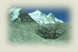
DAY 4: Joshimath- Auli (6 hours) & commence trek to Gurson meadow
After breakfast we will continue our drive to the ski resort of Auli. At 2600 meters you will begin to
Appreciate the alpine air after the temperatures of the Indian Plains. We commence our trek for two hours, following a trail to the highest ski lift – with impressive views of Nanda Devi at the head of the Rishi Gorge – before entering a holy oak forest to our camp at Gorson
Meadow (3080 meters).
DAY 5: Gorson Bugyal to Chitraganta (4 to 5 hours)
Beyond Gorson Bugyal the trail crosses a series of beautiful meadows to a ridgeline that affords a birds eye views up the Rishi Ganga. We then follow a trail through pine and oak forest for two to three km to the meadow at Chitraganta (3300metres). From camp we appreciate the impressive snow capped ridgeline including Chaukhamba 1 (7138metres), Chaukhamba 2 (7068 metres), Chaukhamba 3 (6974metres) and Chaukhamba 4 (6854metres) on the far side of Joshimath. The shepherds living in the vicinity, mostly from Rishikesh or Haridwar, graze their flocks of sheep and goats throughout the summer months.
DAY 6: Chitraganta to Kuari Pass (2 to 3 hours).
A short stage to assist acclimatization. We head along a ridge for an hour gaining views of the Kuari pass as well as the numerous peaks that stretch as far as the horizon. From our camp in the vicinity of the pass we gain spectacular views of the Himalayan and Zanskar ranges. Our guides will help you identify them. North of Joshimath is the Chaukhamba Range, Nilkanth (6596 metres) and Narayan Parbat (5965metres), while the peaks of the Zanskar Range, including Mana Peak (7272metres),3 Kamet (7756metres) and Abl Gamin (7355metres), extend to the Tibet border. In the middle foreground, the main Himalayan chain in the vicinity of the Bhyundar Valley and Hem Kund includes Nilgiri Parbat (6474metres), Rataban (6166metres), Ghori Parbat (6708metres) and Hathi Parbat (6727metres). Dunagiri (7066metres) dominates the peaks to the north of the Nanda Devi Sanctuary, which also include Changabang (6864metres) and Kalanka (6931metres).
DAY 7: Kuari Pass to Sutoli (5 to 6 hours).
The Kuari Pass (3530 metres) is just a small col in a grassy ridge. From the pass our guides can point out Sutoli meadow and the route we follow in what is a challenging stage. From the pass there is a steep descent to a small shepherd encampment at Dakwani (3300 metres). The meadow marks the upper limit of the mixed oak and pine forest and time for a short break before we descend to a side river (2515 metres). There follows another ascent and descent (steep again in places ) to an impressive waterfall before a gradual climb through the forest to Sutoli meadow (2850 metres). From camp you savour views back towards the Kuari pass and the pristine forests that characterise the upper section of
the valley.
DAY 8: Sutoli to Jhangi (5 to 6 hours).
After the vigour’s of the previous stage we follow a series of well-defined trails leading through a series of traditional hill villages. We appreciate the almost Arcadian scene with the hills dotted with two-storied slate roofed dwelling set amid fields of maize and corn. After several hours we descend through bamboo and tropical undergrowth to the Brithi Ganga. There is a large suspension bridge over the river before a 200-metre ascent to Jhangi (2000 metres), a small pleasant village situated in the upper Brithi Ganga Valley.
DAY 9: Ghangri to meadow camp (4 hours).
The trail ascends through oak and rhododendron forest and across a series of meadows from where we gain panoramic views of the Brithi Ganga Valley and the snow capped peaks looming above the forested ridges at the head of the valley. There is no shortage of campsites with plenty of time that afternoon to explore the forests and meadows in the vicinity.
DAY 10: Camp to Gorli (3 hours)
We commence with a short ascend to the wooded ridge (marking the watershed between the Brithi Ganga and the Nandakini Valley). There follows a gradual descent through the pastures and forests where the villagers from large village of Ramni graze their animals before descending to a beautiful camp just above the village of Gorli (2345metres). That afternoon we may decide to walk to the nearby Ramni village and visit the small bazaar.
DAY 11: Gorli to Pehri (4 to 5 hours).
A well-defined trail leads high above the Nandakini River and through several substantial villages. On this stage we can appreciate the intricate wooden carving of Ganesh (the elephant-headed god) in many of the houses as well as the simple Hindu temples that line the trail. In between the villages we enter oak and rhododendron forest as we make our way to our camp at Pehri (1940 metres).
DAY 12 Pehri to Sutol (3 to 4 hours)
From Pehri (2500metres) we continue along a village trail through a number of settlements before a descent to a major tributary. There follows a trek through rhododendron and blue pine forest to Sutol (2200metres), one of the most substantial villages in the upper Nandakani valley. Just beyond the village there is an excellent campsite alongside the Nandakini River.
DAY 13: Sutol to Wan (5 hours).
Views of Trisul (7120metres) loom above Sutol as we ascend through spruce and oak forest to the village of Kunol (2600metres). Barking deer have been seen in the forest clearing, while the heavy spiked collars worn by the shepherd dogs reflects their need for protection from the forest leopards. The village at Kunol (2600metres) is set in an idyllic location with views of the summits of the high peaks north of Joshimath. A small ridge separates Kunol and Wan where views of the main Himalaya are complemented with impressive views south down the Bedni Ganga towards the Indian plains. We camp above the village of Wan (2450metres) in the delightful grounds of the Forest Rest House.
DAY 14: Wan to Badni Bugyal (5 hours).
From Wan the trail ascends to a meadow complete with a small temple with views of Trisul at the head of the valley. There follows a short descent to a small tributary, before we commence the ascent to Badni Bugyal. The trail through the forest is steep in places. The oaks continue to around 3000 metres, while the pines and rhododendrons thin out at 3200 metres. This marks the upper limit of the forest, as there are no silver birch trees in this region of the Garhwal. The 800 metre climb through the forest takes around three hours. It is a further three km across the meadows to the camp at Badni Bugyal.The alpine camp at Badni Bugyal (3350 metres) would rival the best in the Himalaya. To the west, the views of the Himalaya stretch as far as the peaks in the vicinity of Gangotri, while the Chaukhamba Range and the peaks beyond Joshimath are also visible. To the north, the peaks of Trisul (7120 metres) and Nanda Ghunti (6309 metres) rise above the alpine ridges.
DAY 15: Badni Bugyal to Bhoga Basa (4 to 5 hours).
From camp there is a gradual climb up and along the north-east ridge towards Trisul. Here on the trail continues around the contours before ascending steeply in places to a small shrine on the ridgeline, which marks the catchment divide between the Badni Ganga and the Nandakini River. The camp at Bhoga Basa (4100 metres) is a couple of km beyond the temple.
DAY 16: Bhoga Basa to Rup Kund & return to Badni Bugyal (7 to 8 hours).
The 500 metre climb to the sacred lake of Rup Kund takes around two to three hours. En route there are some steep rocky sections just before Rup Kund, which may require a bit of scrambling to reach the lake.Rup Kund (4550 metres) has no outflow and is covered in snow for 10 months of the year. If the waters arte not under snow you may glimpse human bones that legend has it are dated to a time when a party of pilgrims were trapped by bad weather in the 14th century.
There is a possible optional climb to Jyuri Gali (4620 metres) that marks the divide between the
headwaters of Rup Kund and Hom Kund, the main sources of the Nandakini River. From Rup Kund it takes about two hours to return to Bhoga Basa and a further three hours back to Badni Bugyal.
Note: Due to the spring snow melt it is unlikely that the May departure will be able to camp at Bhoga Basa or reach Rup Kund. Alternative day treks out of Badni Bugyal will however be included depending on group interests and preferences.
DAY 17: Badni Bugyal to Didana (4 hours).
The trail leads south across the alpine grazing meadows to Ali Bugyal. The views are again magnificent, both across to Joshimath and south to the Indian plains. The trail then descends steeply through the forest to the village of Didana (2450 meters).
DAY 18 Didana to Loharjang (4 to 5 hours)
After crossing the substantial bridge over Bedni Ganga the trail then gradually ascend through pine, fir, oak and bamboo forest and past cascading side streams to the jeep trail coming from Lohrajang. It is a further six km along the jeep trail to the prosperous village of Loharjang.
DAY 19: Drive to Nainital (8 to10 hours).
Our bus will take a full day to Nainital. At first the road descends to the Pindari valley before crossing the ridges of the Himalayan foothills to Nainital.
DAY20: At Nainital
We spend two days exploring the bustling hill resort of Nainital. There is plenty to do including
Wandering around the lake and visiting the main bazaar at Mallital or taking out a boat on the lake. Other options include undertaking a day walk to one of the many vantage points above the town where you may enjoy one last panorama of the snow capped Himalayan peaks.
DAY 21: Drive to Kathgodam, train to Delhi
From Nainital we drive down to the plains and the station at Kathgodam to board our early morning train to Delhi.
End of tour.
NOTE – This schedule is a guide only. There are many factors your guide has to consider inMaking final decisions including; weather and snow conditions, logistics and local conditions,And capability of group members. Being an adventure trip it is by its very nature going toChange and be modified for the benefit and safety of all and your cooperation on these aspects is
Vital.
For tour costs and other details please contact: Sanjay/Sunil at